


Low in stock, only 4 left
Price:£10.98
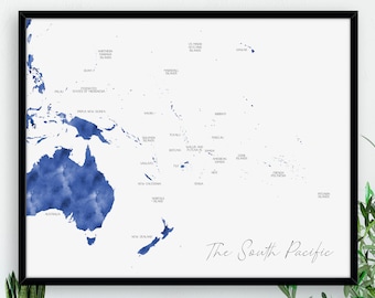
Digital South Pacific Map, Labelled Watercolour Map Print, Map of Oceania, Large Map Wall Hanging, Digital Download, Pacific Islands, NZ
-
PLEASE:
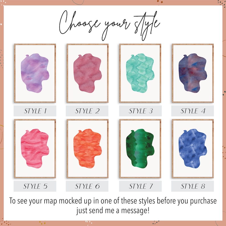
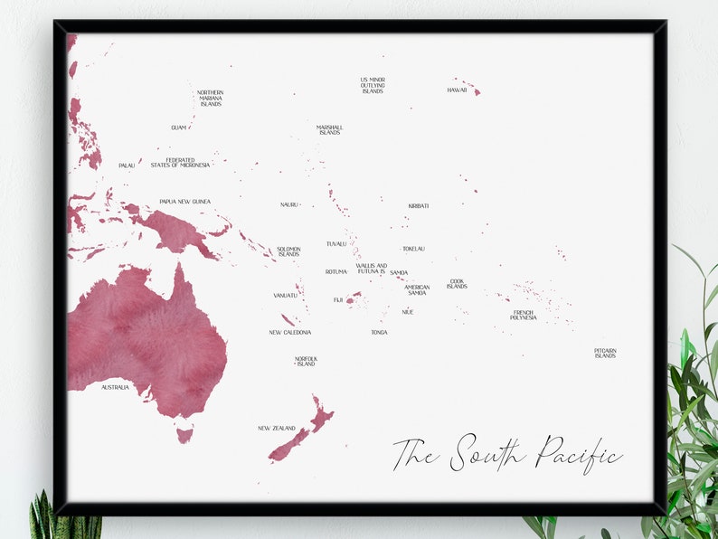
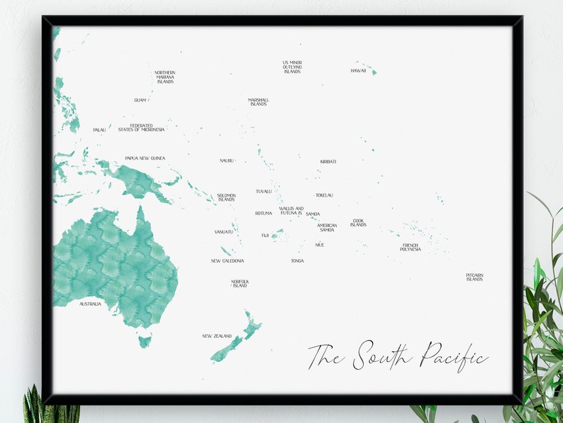
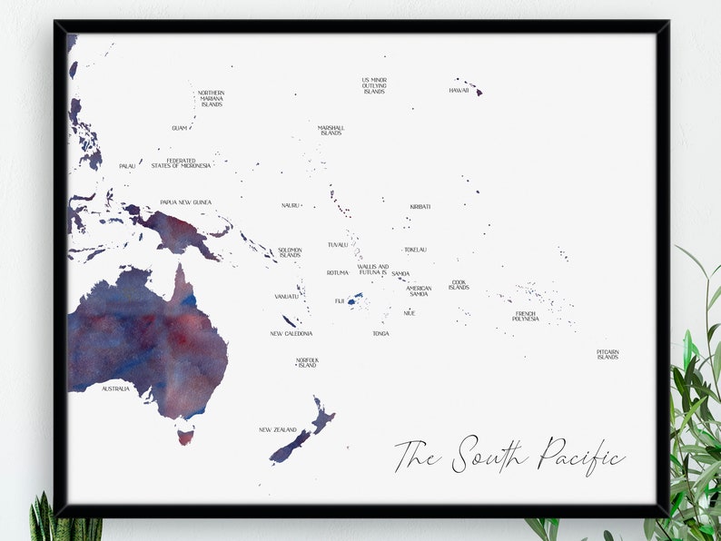
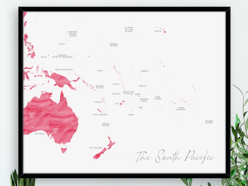
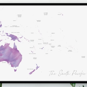
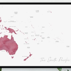
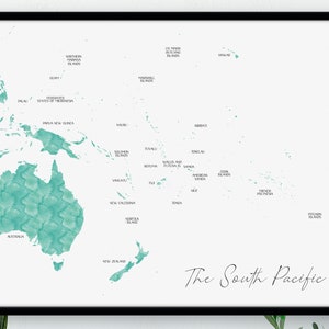
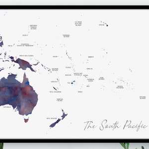
☀︎ Choose your colour (see photo 2)
☀︎ Enter the size you want in the personalisation box
☀︎ Add to basket!0/256
You can only make an offer when buying a single item.
Highlights
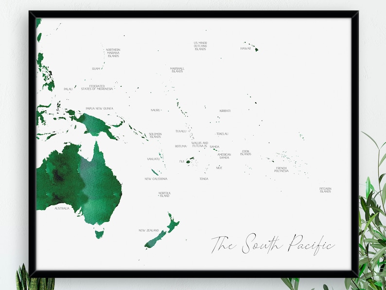
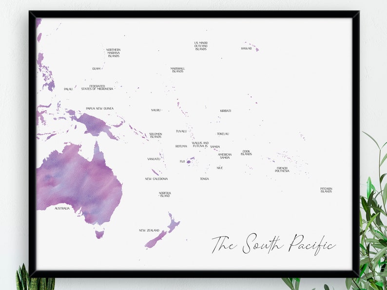
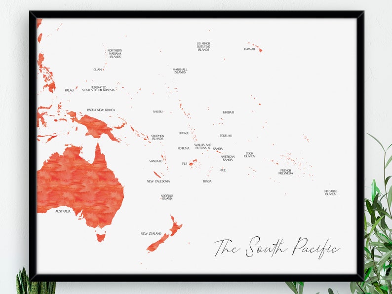
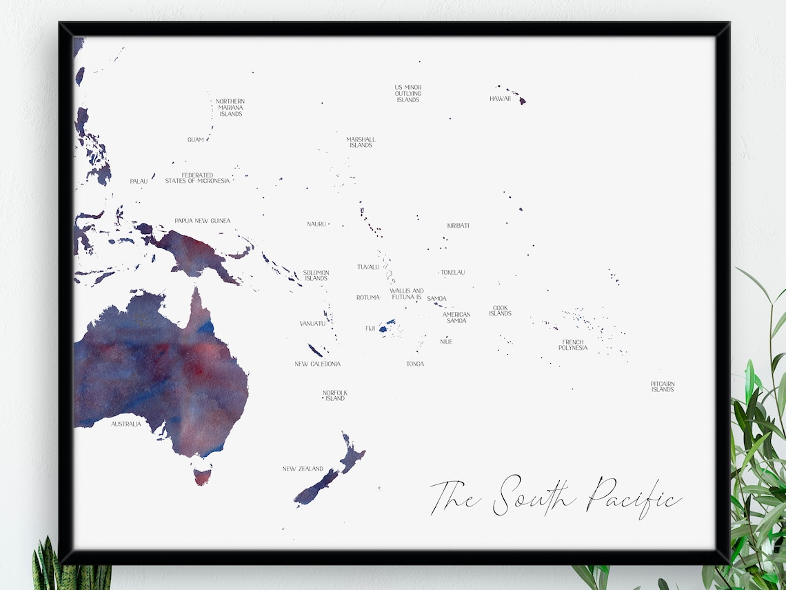
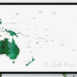
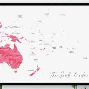
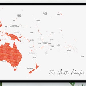
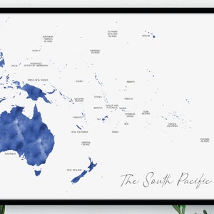
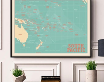
DESCRIPTION // A digital watercolour map of the South Pacific region. Available in 8 different styles and either as a digital file or a physical print that is shipped to you.
Locations on the map include all of Oceania: Australia, Fiji, Kiribati, Marshall Islands, Federated States of Micronesia, Nauru, New Zealand, Palau, Papua New Guinea, Samoa, Solomon Islands, Tonga, Tuvalu, Vanuatu, American Samoa (U.S. territory), Cook Islands (associated with New Zealand), French Polynesia (overseas collectivity of France), Guam (U.S. territory), New Caledonia (special collectivity of France), Niue (self-governing state in free association with New Zealand), Norfolk Island (external territory of Australia), Northern Mariana Islands (U.S. territory), Pitcairn Islands (British Overseas Territory), Tokelau (dependent territory of New Zealand), Wallis and Futuna (overseas collectivity of France).
INSTRUCTIONS//
☀︎ Choose your colour (see photo 2)
☀︎ Enter the size you want in the personalisation box
☀︎ Add to basket!
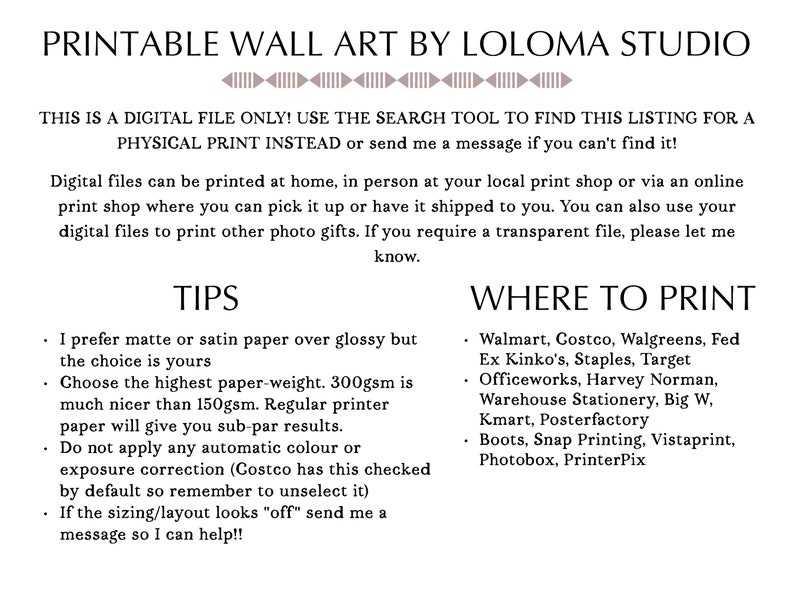
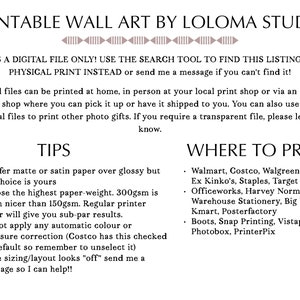
Digital files will be uploaded within 36 hours. You can print at home, take to your local print shop or for upload to a printing service such as Officeworks or Staples and have it delivered straight to your door.
CUSTOMISATION // Get your print in a different font, different pattern or with different locations marked. Send me a message for a quote.
SHARE THE LOVE // I love seeing my prints in the wild. Tag me on Instagram - @lolomastudio #lolomastudio
T&Cs // This item is for personal use only, either for yourself or as a single gift for one person, and is strictly not for resale or commercial use. Colours on screen may vary slightly to printed colours. Slight layout changes may occur with different sizing. Frames, hangings and other accessories shown are not included.
© Loloma Studio, all rights reserved.
Made-to-order download
Files will be available after the seller completes your order. Here's how.
Made-to-order digital items don’t accept returns or exchanges. Please contact the seller about any problems with your order.
Etsy Purchase Protection
Shop confidently on Etsy knowing if something goes wrong with an order, we've got your back for all eligible purchases —
see programme terms

Be the first to review this item

Speedy replies Has a history of replying to messages quickly.
Rave reviews Average review rating is 4.8 or higher.
More from this shop
Visit shop-
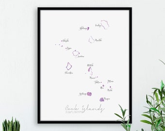
Cook Islands Map Portrait / Labelled Watercolour / Digital or Printed Wall Art / Large Map Poster / Gift Idea / Giclee Print / Home Decor
£9.97
-
The South Pacific Map / Labelled Watercolour / Canvas or Printed Wall Art / Large Map Poster / Gift Idea / Giclee Print / Home Decor / Art
£23.41
-
Digital download
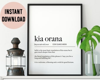
Cook Islands Kia Orana (Hello) Definition Digital Print
£6.65
-
Digital download
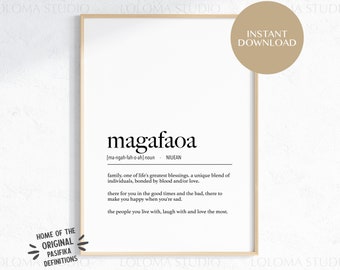
Niue Magafaoa (Family) Definition Digital Print / Niuean Language / Polynesian Home Decor / Niue Poster / Instant Download / Niuean Art
£6.65
-
South Pacific Map Print: Retro Tropical Style, Framed Giclée Poster
£55.88
-
Original 1882 Map of Colonial Oceania by Hunt & Eaton. Antique
£35.77
-

1888 Antique OCEANIA Map George Cram Pacific Islands Map Polynesia Map Beach Decor Wall Art Anniversary Gift For Wedding Honeymoon 3734
Sale Price £39.03
Original Price £40.78
-
1897 Oceania Original Antique Map - Australia - New Zealand - Micronesia - Pacific Islands - Mounted and Matted - Available Framed
£32.00
-
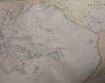
1859 OCEANIA and PACIFIC OCEAN extra large rare original antique A & C Black Map from Admiralty Surveys - Pacific Islands - Australasia
£65.00
-
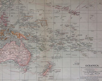
1903 Oceanica Original Large Antique Map showing colonial powers, railways, steamship lines, Ocean Depths - Pacific Ocean - Pacific Islands
£12.00
-
1882 THE PACIFIC OCEAN Large Original Antique Map, 15 x 22 inches, Home Decor, Cartography, Geography, Vintage Decor, wall map
£22.00
-
Guano Islands in the Pacific Ocean Map - 1872
£78.92
-
1827 Map of Tonga – Early 19th Century South Pacific Exploration Map Showing Islands, Harbors, Native Settlements & Navigational Details
Sale Price £34.84
Original Price £46.45
-
Digital download
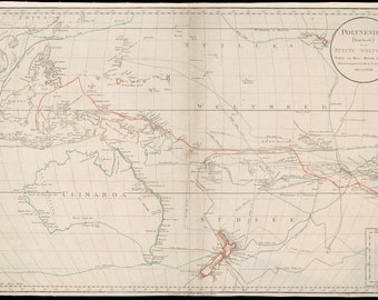
Map of Australia and Polynesia. Vintage late 1700's map of South Pacific. Including attached Van Diemens land (Tasmania). New Zealand.
£6.59
-
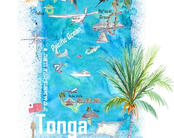
Tonga Map Wall Art – South Pacific Island Travel Print Polynesia Decor
£18.59
-
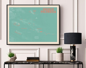
French Polynesia Map Print: Retro South Pacific Islands Poster
£55.88


