


Only 1 left and 6 views in the last 24 hours
Price: $49.73+
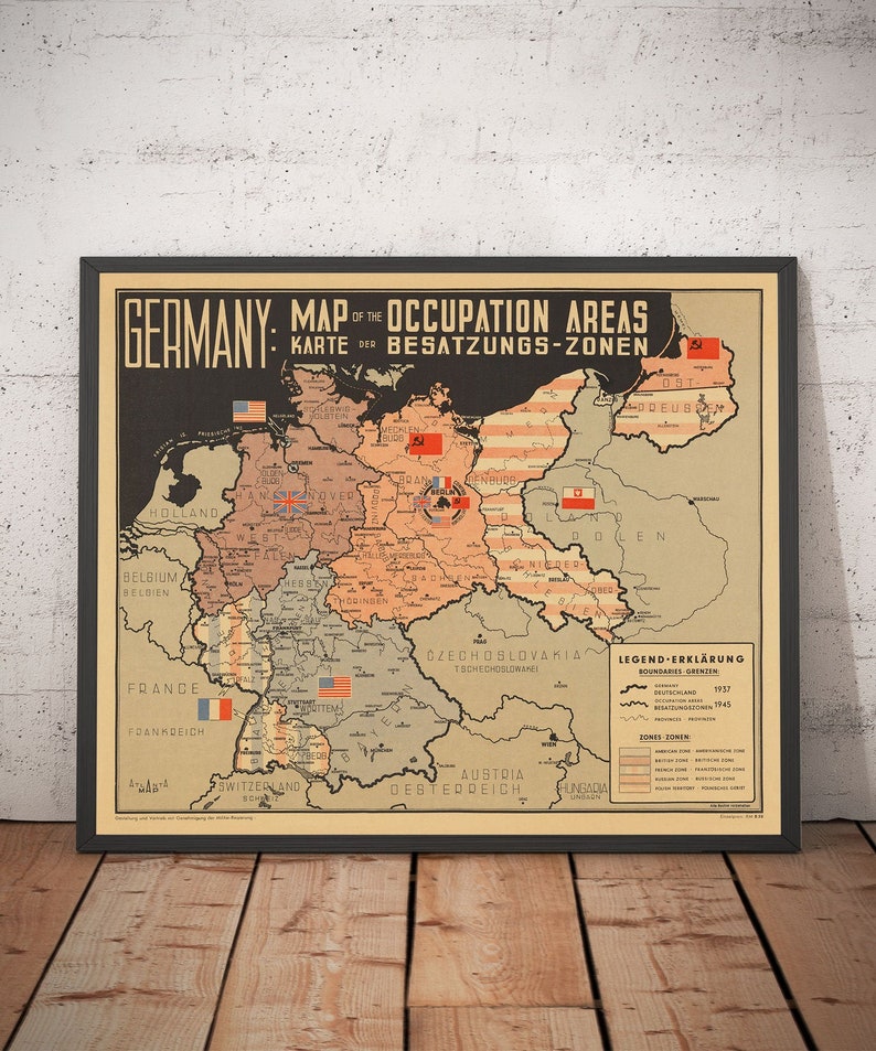
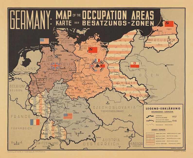
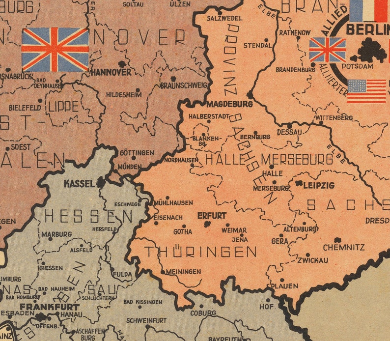
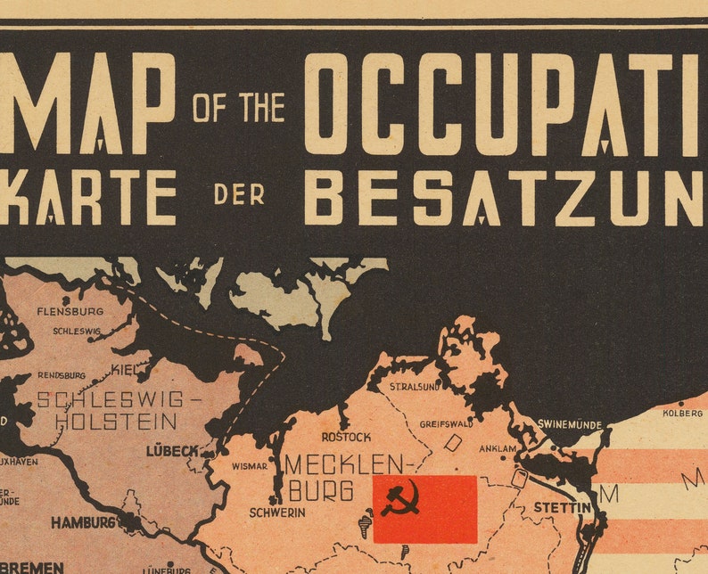
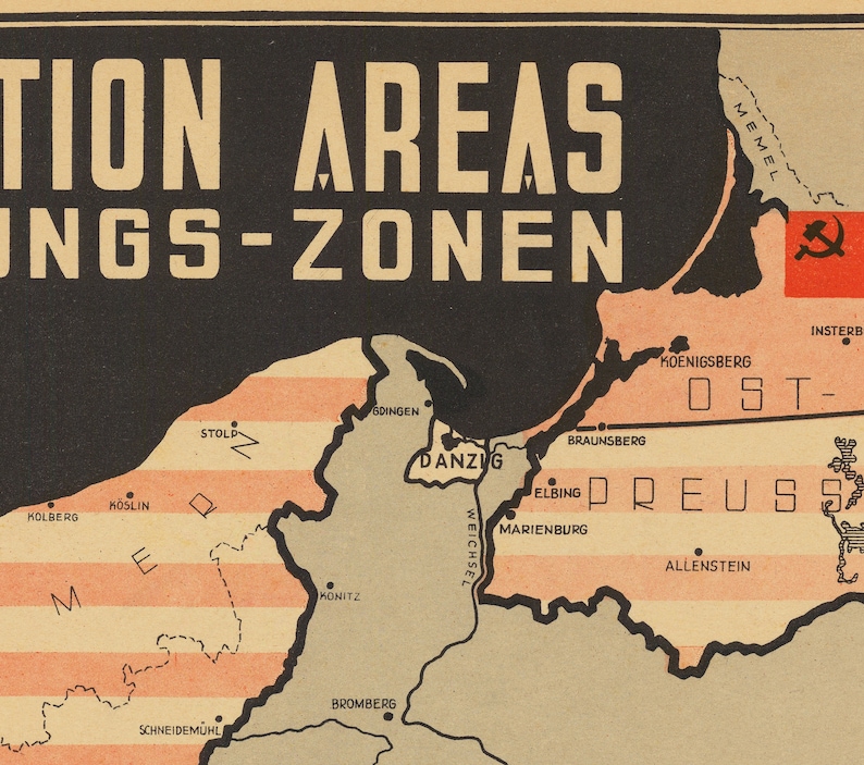
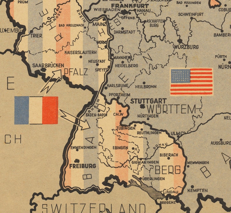
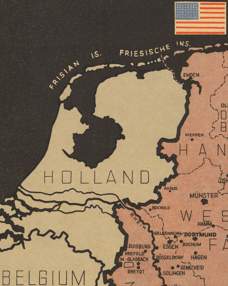
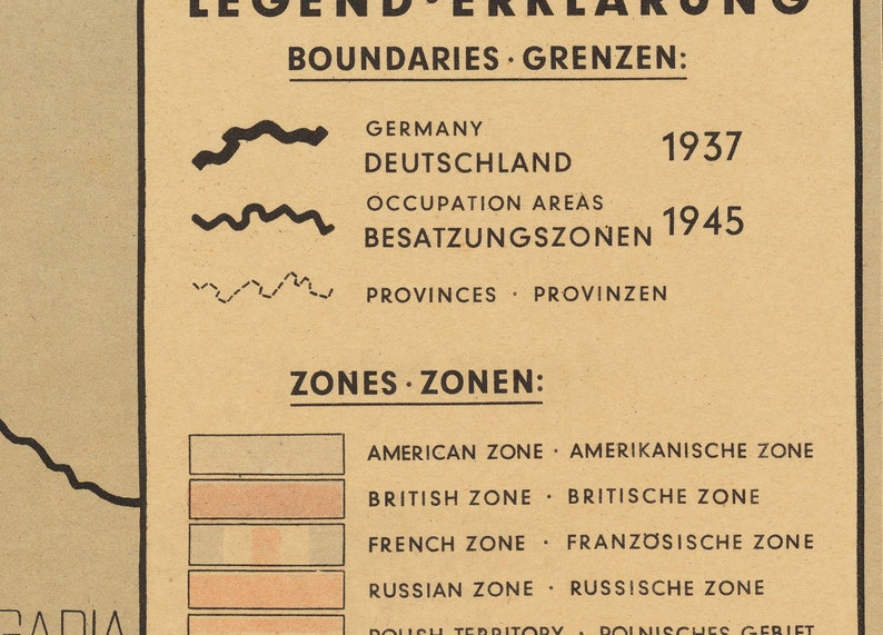
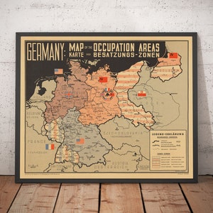
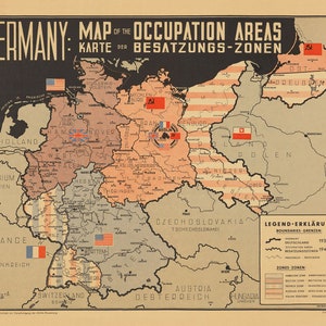
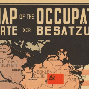
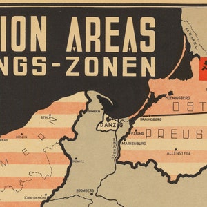
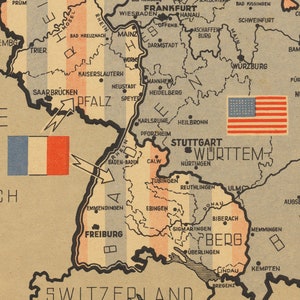
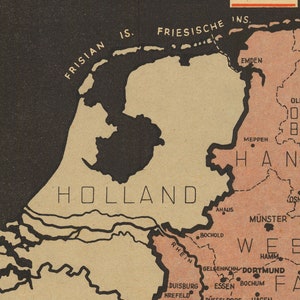
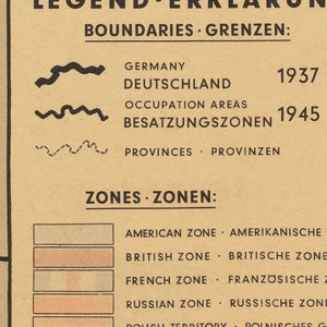
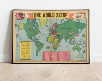
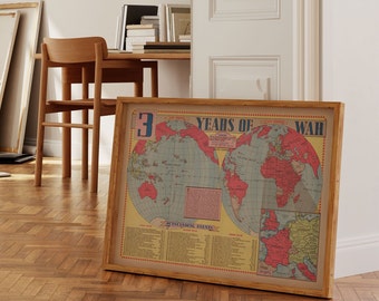
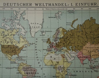
Nazi Germany World War 2 Map - Post War Potsdam Chart - Communist East & Allied West Berlin Occupation - Framed or Unframed
Star Seller
Star Sellers have an outstanding track record for providing a great customer experience—they consistently earned 5-star reviews, shipped orders on time, and replied quickly to any messages they received.
Your order should arrive by this date if you buy today. To calculate an estimated delivery date you can count on, we look at things like the carrier's latest transit times, the seller's processing time and shipping history, and where the order is shipping to and from.
Returns & exchanges accepted
You can only make an offer when buying a single item
Star Seller. This seller consistently earned 5-star reviews, shipped on time, and replied quickly to any messages they received.
-
Order today to get by May 3-13
Your order should arrive by this date if you buy today. To calculate an estimated delivery date you can count on, we look at things like the carrier's latest transit times, the seller's processing time and shipping history, and where the order is shipping to and from.
-
Returns & exchanges accepted within 30 days
Buyers are responsible for return shipping costs. If the item is not returned in its original condition, the buyer is responsible for any loss in value.
-
Free shipping
There was a problem calculating your shipping. Please try again.
Etsy Purchase Protection
Shop confidently on Etsy knowing if something goes wrong with an order, we'll make it right for all eligible purchases —
see program terms

Captcha failed to load. Try using a different browser or disabling ad blockers.
Other reviews from this shop
|
(1,292)
Love the poster and fast communication! Thank you once again!

Karina Proshina Apr 29, 2024
Superb quality reproduction map on a very high quality medium. Great detail & colouring too. Highly recommended!

Grant Willcox Apr 27, 2024
Second print purchased , and I’m very happy with both. I’m running out of wall space. A great deal for the price . I trust this shop and will use them again. Thanks

Response from Sebastian Anthony
Thank you for repeat custom, David! I really appreciate it. And the Moon looks fantastic :) Get in touch before you order next time and I'll arrange a discount for you. Regards, Sebastian.
David Fisher Apr 26, 2024
Photos from reviews
More from this shop


GIFT MODE
Thoughtful Mother's Day gifts for ALL her interests