



Bacon's Chart of Useful Knowledge Print: 1910s Vintage Infographic
Low in stock, only 2 left
NowPrice:$75.96+
Original Price: $94.95+
20% off
Sale ends on November 23
Your order should arrive by this date if you buy today. To calculate an estimated delivery date you can count on, we look at things like the carrier's latest transit times, the seller's processing time and shipping history, and where the order is shipping to and from.
Returns accepted
You can only make an offer when buying a single item
Highlights
🇺🇸 Made & Delivered in the USA 🇺🇸
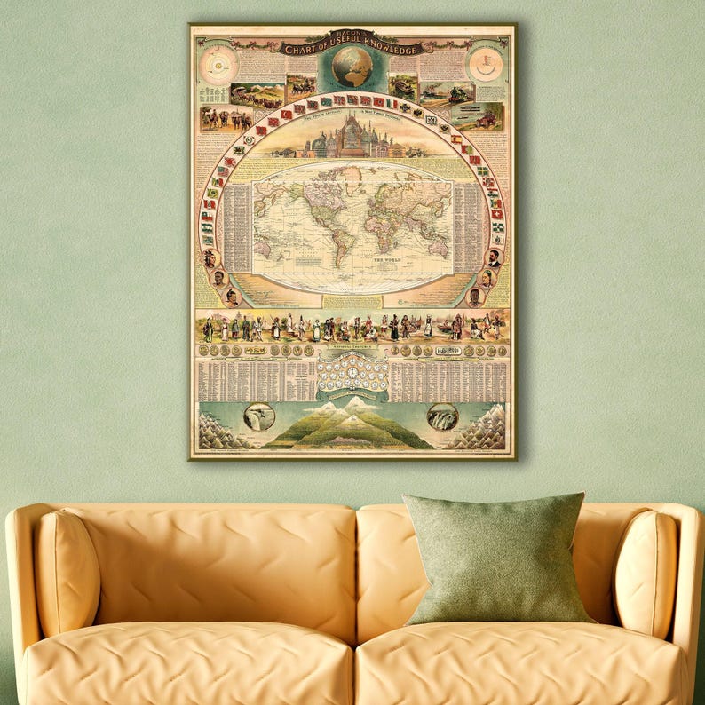
Bacon's Chart of Useful Knowledge, 1910s.
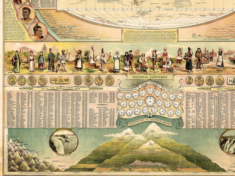
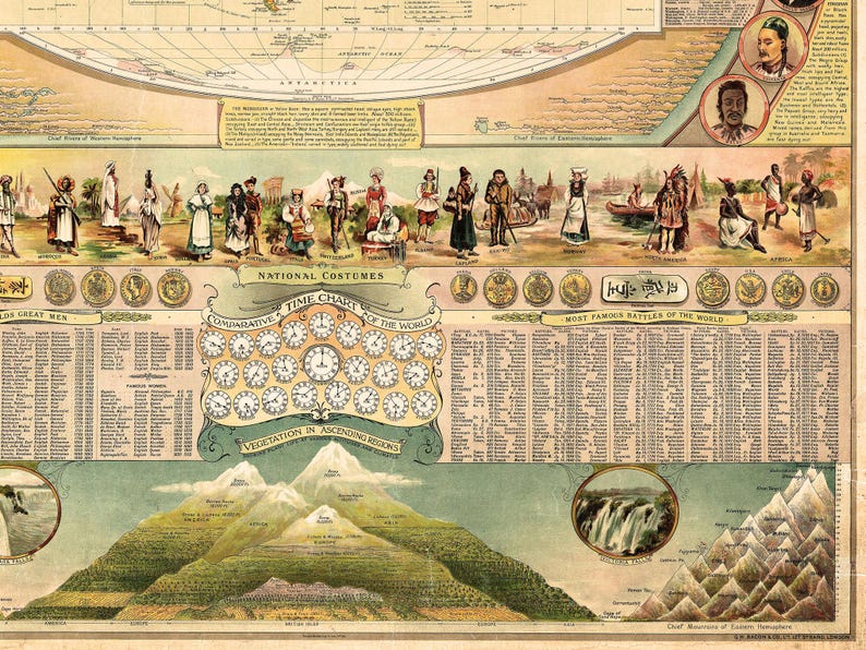
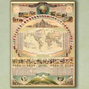
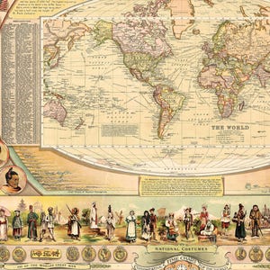
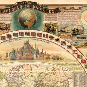
Large wall-map style compendium of all 'useful knowledge' - a densely informative chromolithographic masterpiece. Bacon's map/chart emerges out of the great age of data collection - a period following the Age of Discovery in which improved transportation and intellectual optimism encouraged a furious effort to catalog, 'collect', and contextualize the natural world. The present map synthesizes these efforts into a single dense aimed at both the next generation of explorer/scientists and the armchair adventurer. Herein, information is effectively summarized and categorized, embracing an impressive range of subjects: astronomy, geography, transportation, ethnology, geology, anthropology, and more.
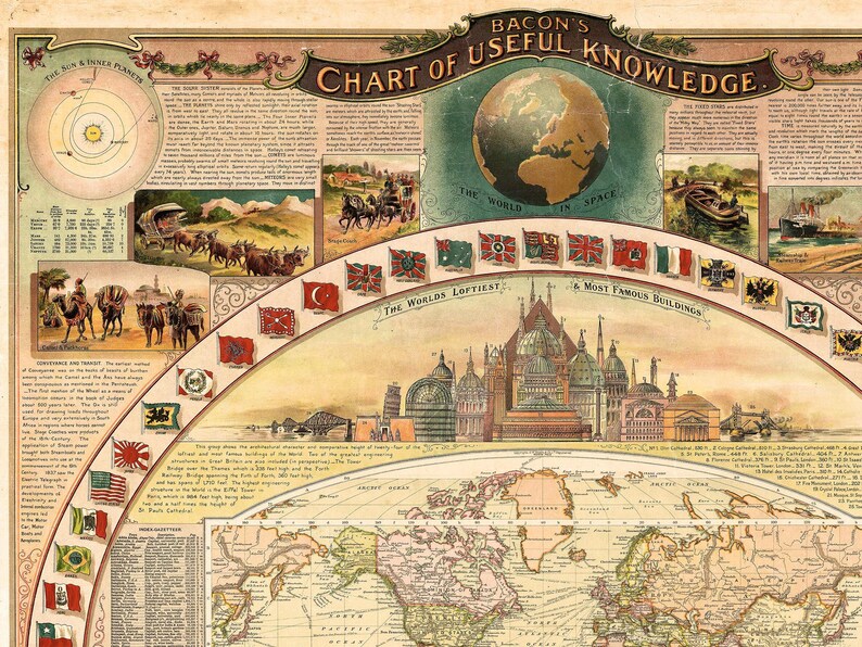
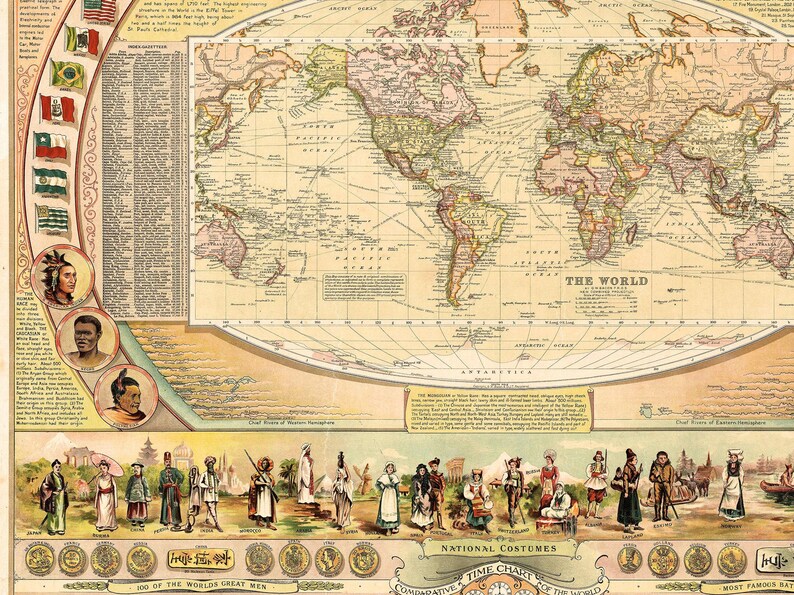
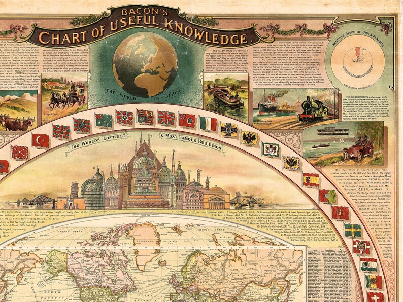
The chart's focal point is the world map at center. The map presents the world on a Mercator projection with countries, trade routes, distances, and other detail defined. It is surrounded by the flags of numerous nations, as well as a comparative chart of twenty-four man-made structures, and another of rivers of the Eastern and Western Hemispheres.
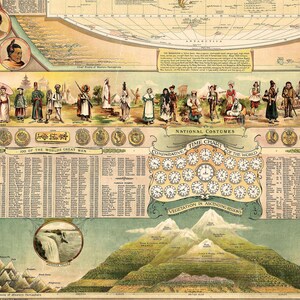
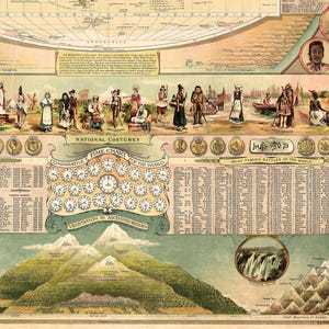
The chart continues with illustrations of some of the world's coinage with exchange rates to British pounds. A table listing '100 of the World's Great Men' from Homer to Cecil Rhodes occupies the left portion of the sheet below the currency and is followed by a list of seventeen famous women. Both are decidedly Anglo-centric. A similar chart lists the 'Most Famous Battles of the World' from the Battle of Troy to the 1905 Battle of Tsushima. A 'comparative time chart of the world' relative to Greenwich separates the two tables.
A comparative chart of the heights of the world's tallest mountains occupies the bottom part of the chart. The chief mountains of the Western and Eastern Hemispheres appear in the left and right, respectively, with each peak identified by name. At center, a diagram presents plant life at various altitudes.
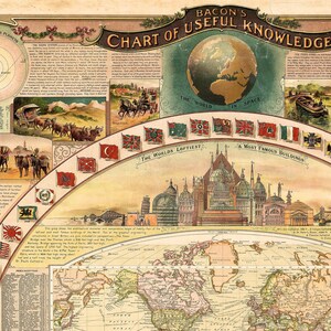
At the top of the sheet, diagrams and a short text focus on the solar system. The diagram in the upper left illustrates the inner solar system, presenting Mercury, Venus, Earth, and Mars' orbits around the Sun. A chart comparing the size of the eight planets and the Sun occupies the top right. An illustration of the Earth as a planet appears at top center.
Below the discussion of the solar system are six vignettes illustrating modes of transportation. These progress from camels and donkeys to ox-drawn wagons and stagecoaches, ending with steamships, steam engines, automobiles, and airplanes. A short discussion of these 'conveyances' appears along the left border.
MATTE PAPER - UNFRAMED !
- 240 gsm heavy weight museum quality matte paper
- Ideal for high resolution photos
- Extremely smooth natural white surface, perfect for art
- UNFRAMED, Print only.
CANVAS - UNFRAMED
• High-quality inkjet art matte canvas (400 gsm)
• Great for high-end art and photo prints
• IMPORTANT NOTE: This is an unframed and unstretched canvas print. The product does not come with stretcher bars or a frame. The canvas is delivered rolled in a protective tube, giving you the freedom to personally choose the perfect frame that matches your decor and taste.. If you need to stretch the canvas around a frame, please choose, if available, 2" of extra border from the "Material" menu.
All prints have an extra 5 mm (0.2 inches) white margin around the main image. This helps ensure no information is lost from the edge of the print when framing. If you don’t need the margin, for example because you plan to order a frame that is the exact same size as stated image size, then please drop me a message to remove the extra white margin around the image.
The print will be send in a rigid cardboard tube.
We provide only very high quality prints so we will be grateful if you leave us a feedback after receiving your order.
Return to my shop here: http://www.etsy.com/shop/Historilicious
Please read the shop policies for important information.
All the maps and prints we sell are vintage reprints, so their age must be kept in mind when considering condition.
Often maps (and large prints) have centerfolds; they may also often have some edge discoloration or general discoloration through age, repaired tears, foxing or irregular staining, soiling, etc.
Thank you!
Production partners
Historilicious makes this item with help from-
Order today to get by Nov 13-18
Your order should arrive by this date if you buy today. To calculate an estimated delivery date you can count on, we look at things like the carrier's latest transit times, the seller's processing time and shipping history, and where the order is shipping to and from.
-
Returns accepted within 30 days
Buyers are responsible for return shipping costs. If the item is not returned in its original condition, the buyer is responsible for any loss in value.
-
Free shipping
-
Ships from: Anaheim, CA
There was a problem calculating your shipping. Please try again.
Etsy Purchase Protection
Shop confidently on Etsy knowing if something goes wrong with an order, we've got your back for all eligible purchases —
see program terms

Be the first to review this item

Speedy replies Has a history of replying to messages quickly.
Rave reviews Average review rating is 4.8 or higher.
More from this shop
Visit shop-

Geology Wall Decor, Vintage Rock Strata Art Print | Canvas or Paper | Educational Home Study Decor
Sale Price $75.96
Original Price $94.95
-

Geological Wall Art, Vintage Earth Cross Section Print - Victorian Cross Section Poster
Sale Price $75.96
Original Price $94.95
-

Biblical Genealogy Chart: Christian History - Vintage Scripture Print from Adam to Christ | Religious Education
Sale Price $75.96
Original Price $94.95
-

Vintage Lufthansa Flight Route Map Poster: 1939 Aviation Art
Sale Price $55.07
Original Price $68.84
-

Vintage World History Time Chart Print: French Language Wall Art
Sale Price $55.95
Original Price $74.61
-
Geography Vintage Chart Print| Geographical Poster| Home Gift Wall Art
Sale Price $43.71
Original Price $58.29
-

Genealogy Tree of the English Monarchy, Vintage Chart Print, British Monarchy Wall Art Home Gift
Sale Price $45.46
Original Price $60.62
-

Adams Synchronological Chart 1881 History Timeline Print | World History Poster
Sale Price $70.31
Original Price $89.00
-
Vintage US Political Timeline Print: 1789 Historical Chart
Sale Price $42.84
Original Price $57.12
-

The Histomap of Evolution: Emergence & Progression of Life | Vintage Timeline with FRAME | Wall Art Print Vintage Educational Poster FRAMED
Sale Price $47.20
Original Price $59.00
-

The Histomap of Religion: The Story of Man's Search for Spiritual Unity | Vintage Timeline w FRAME | Print Vintage Educational Poster FRAMED
Sale Price $47.20
Original Price $59.00
-
Universal History Timeline Print | Chronological World Chart (4004 BC - 1820 AD)
Sale Price $47.40
Original Price $60.00
-
1893 Map and History Chart of Mexico – Post-Independence Mexican Republic Map Featuring Timeline of Key Events, Borders, & Political Changes
Sale Price $66.00
Original Price $88.00
-
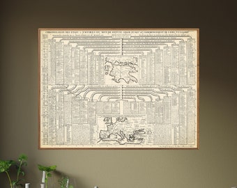
Empires of the World from Adam to the Common Era: Timeline Tree - Vintage Historical Chart Print
Sale Price $42.84
Original Price $57.12
-
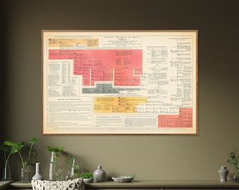
England: Historical Timeline - Vintage Chart Print, Genealogical & Chronological Table
Sale Price $40.22
Original Price $53.62
-
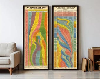
Double Set of Visual Timeline History: Histomap of Evolution and Histomap of Religion | Timeline Print Wall Decor| World Timeline Chart
Sale Price $40.29
Original Price $51.00
Shoppers with similar taste loved these
-
Digital download
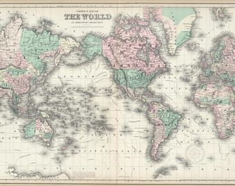
Vintage 1874 World Map Print: Historical Mercator Projection (Digital Download)
$1.95
-

Digital download
Vintage French World Map: Colorful Antique Planisphere (Digital Download)
Sale Price $7.02
Original Price $9.36
-

Digital download
Lámina de mapa mundial vintage, arte mural de estilo antiguo (descarga digital)
$4.75
-

Digital download
printable world map, wall art, home decor, journaling, arts and crafts, scrapbooking, digital download no. 162
$3.00
-

Digital download
Lámina de mapa mundial vintage, atlas antiguo para decoración de oficina (descarga digital)
$4.30
-

Digital download
Vintage Map Junk Journal Pages | Printable Antique World Maps | Digital Scrapbook Kit | Old Aged Distressed Paper | Grunge Download
Sale Price $1.34
Original Price $2.98
-

Digital download
Vintage World Map Set of 3: Retro Antique Style (Digital Download)
Sale Price $7.36
Original Price $8.66
-
Digital download
Vintage World Maps, Junk Journal Digital Papers, Old Atlas Printable, Scrapbook Pages, Ephemera Kit, Paper Craft Supply
Sale Price $4.19
Original Price $5.99
-

Digital download
Mapa mundial vintage impreso, estilo antiguo (descarga digital)
$4.50
-

Digital download
Vintage Map Junk Journal Pages, Printable Antique World Maps, Digital Scrapbook Kit, Old Aged Distressed Paper, Grunge, Instant Download
Sale Price $1.97
Original Price $3.94
-
Digital download
10 Vintage World Maps
$0.99
-
Digital download
Vintage Map Junk Journal Pages - Printable Antique World Maps - Digital Scrapbook Kit - Nautical Ephemera
$2.99


Looking for more? Find it on Etsy