


Cape Town Nautical Chart Print, Table Bay Map, Vintage Harbor Art (Digital Download)
Item highlights
Seller's description
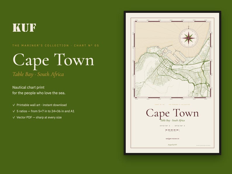
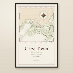
A nautical-chart print of Cape Town and Table Bay — drawn like the working charts that sailors kept on the chart table.
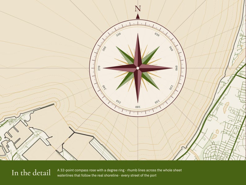
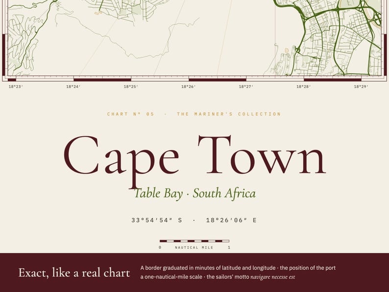
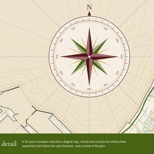
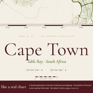
This is not an ordinary city map. Every street of the port and its real shoreline are drawn in fine lines, and around them are the things a navigator would look for: a 32-point compass rose with a degree ring, rhumb lines radiating across the whole sheet, waterlines that follow the coast, and a border graduated in minutes of latitude and longitude — exact for this place. Below the map: the position of the port (33°54′54″ S · 18°26′06″ E), a one-nautical-mile scale and the old sailors' motto, navigare necesse est.
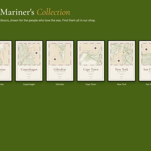
Chart Nº 05 of The Mariner's Collection — our tribute to the people who spend their lives at sea, and to those who wait for them.
✦ WHAT YOU GET
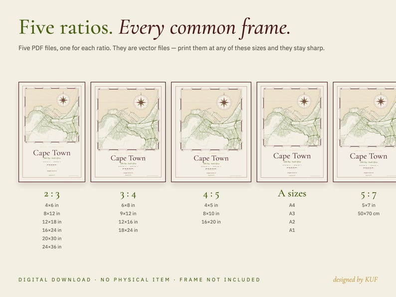
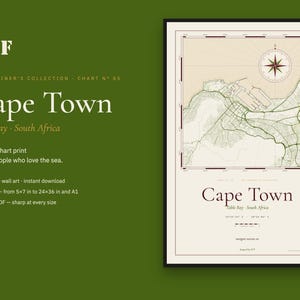
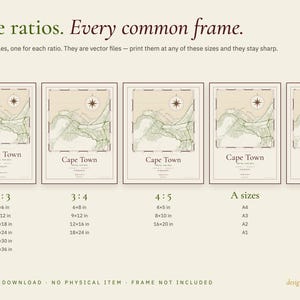
Five print-ready PDF files, one for each ratio:
• 2:3 — for 4×6, 8×12, 12×18, 16×24, 20×30 and 24×36 in
• 3:4 — for 6×8, 9×12, 12×16 and 18×24 in
• 4:5 — for 4×5, 8×10 and 16×20 in
• A sizes — for A4, A3, A2 and A1
• 5:7 — for 5×7 in and 50×70 cm
The files are vector PDFs: they stay perfectly sharp at every one of these sizes.
✦ HOW TO PRINT
• At home, at a local print shop or with an online printing service
• Choose a heavy matte paper for the best result
• Colours: warm paper white, olive, burgundy and brass. They can vary slightly from screen to print.
✦ A THOUGHTFUL GIFT
For sailors, navy families, people who grew up in a port — or anyone who left a piece of their heart in Cape Town.
✦ PLEASE NOTE
• This is a digital product — nothing will be shipped. The frame is not included.
• A decorative print. Not for navigation.
• For personal use only. Please do not share or resell the files.
• Map data © OpenStreetMap contributors.
designed by KUF
If something goes wrong with an order, we've got your back for all eligible purchases. View program terms
Price:$6.99
You can only make an offer when buying a single item
Delivery
Instant download
Your files will be available to download once payment is confirmed. Here's how.
Instant download items don't accept returns, exchanges or cancellations. Please contact the seller about any problems with your order.
Seller's description
Specifications
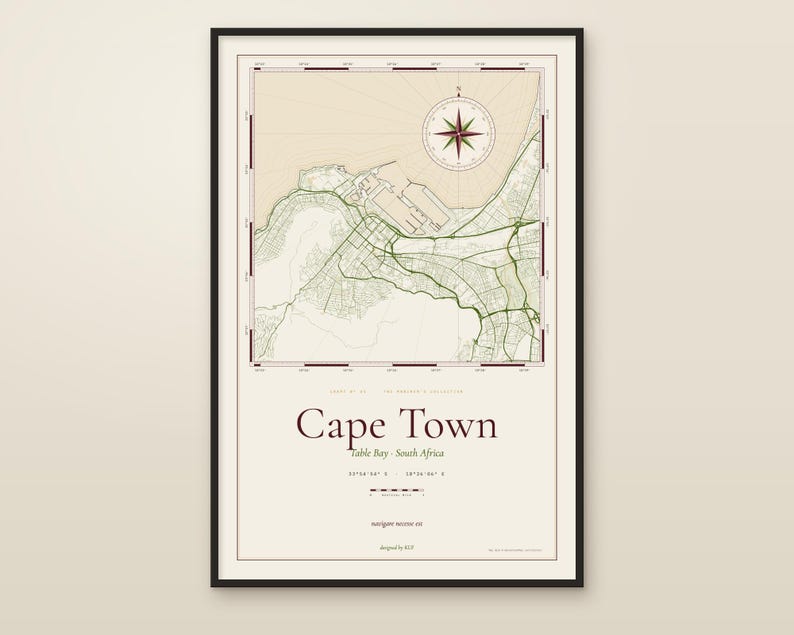
A nautical-chart print of Cape Town and Table Bay — drawn like the working charts that sailors kept on the chart table.
This is not an ordinary city map. Every street of the port and its real shoreline are drawn in fine lines, and around them are the things a navigator would look for: a 32-point compass rose with a degree ring, rhumb lines radiating across the whole sheet, waterlines that follow the coast, and a border graduated in minutes of latitude and longitude — exact for this place. Below the map: the position of the port (33°54′54″ S · 18°26′06″ E), a one-nautical-mile scale and the old sailors' motto, navigare necesse est.
Chart Nº 05 of The Mariner's Collection — our tribute to the people who spend their lives at sea, and to those who wait for them.
✦ WHAT YOU GET
Five print-ready PDF files, one for each ratio:
• 2:3 — for 4×6, 8×12, 12×18, 16×24, 20×30 and 24×36 in
• 3:4 — for 6×8, 9×12, 12×16 and 18×24 in
• 4:5 — for 4×5, 8×10 and 16×20 in
• A sizes — for A4, A3, A2 and A1
• 5:7 — for 5×7 in and 50×70 cm
The files are vector PDFs: they stay perfectly sharp at every one of these sizes.
✦ HOW TO PRINT
• At home, at a local print shop or with an online printing service
• Choose a heavy matte paper for the best result
• Colours: warm paper white, olive, burgundy and brass. They can vary slightly from screen to print.
✦ A THOUGHTFUL GIFT
For sailors, navy families, people who grew up in a port — or anyone who left a piece of their heart in Cape Town.
✦ PLEASE NOTE
• This is a digital product — nothing will be shipped. The frame is not included.
• A decorative print. Not for navigation.
• For personal use only. Please do not share or resell the files.
• Map data © OpenStreetMap contributors.
designed by KUF
-
Designed by
-
Item typeDigital download
-
Digital file type(s)5 PDF
If something goes wrong with an order, we've got your back on all eligible purchases. View program terms
Meet your seller

More from this shop
-
Digital download
Charleston Nautical Chart Print, South Carolina Harbor Map, Vintage Style Wall Art (Digital Download)
$6.99
-
Digital download
Miami Nautical Chart Print, Biscayne Bay Florida Map, Vintage Style Wall Art (Digital Download)
$6.99
-
Digital download
Copenhagen Nautical Chart Print, Vintage Harbor Map, Scandinavian Wall Art (Digital Download)
$6.99
-
Digital download
San Francisco Nautical Chart Print, Vintage Harbor Map, Bay Area Wall Art (Digital Download)
$6.99
-
Digital download
Boston Nautical Chart Print, Vintage Harbor Map, Sailor's Compass (Digital Download)
$6.99
-
Digital download
San Diego Bay Nautical Chart Print, Vintage Harbor Map (Digital Download)
$6.99
-

Vintage Cape Town Map Print, Rustic Grunge Wall Art, Cape Town Poster, Beach House Decor, South Africa Art
$6.95
-
Digital download
Vintage New London, CT Map Poster - Instant Download Map, Connecticut Wall Map, New London Wall Art, Vintage US Map Print
$8.88
-
Digital download
Cape Town Map Print | Map of Cape Town South Africa | Digital Download
$9.16
-
Classic Provincetown Map Print, Grunge Retro Wall Art, Provincetown City Poster, Beach House Decor, Massachusetts United States Art
$6.95
-

Digital download
Cape Town City Map Wall Art Print - Black & White Minimalist Decor, South Africa Poster (Digital Download)
Sale Price $5.11
Original Price $10.23
-
Digital download
Cape Town Area South Africa Map Print, Map Art Poster, City Street Road Map Print, Nursery Room Wall Office Decor, Printable Map
Sale Price $3.89
Original Price $5.99
-
Digital download
Cape Town South Africa Map Print, Map Art Poster, City Street Road Map Print, Nursery Room Wall Office Decor, Printable Map
Sale Price $3.89
Original Price $5.99
-
Digital download
Vintage Portland, ME Map Poster - Instant Download Map, Maine Wall Map, Portland Wall Art, Vintage US Map Print
$8.88
-

Digital download
Vintage Bar Harbor, Maine Map Poster - Instant Download Map - Bar Harbor ME Wall Art - Vintage US Map Print - Maine Wall Decor
$8.88
-
Digital download
Cape Town Map Print, Cape Town South Africa Map Poster, Map Wall Art, Adventure Wall Art, Cape Town Africa Gift, Printable City Map, Wedding
$5.00
-
Digital download
Cape Town Map Print Cape Town Map Poster Digital Download Cape Town South Africa Printable Black And White Instant Download
$6.05
-
Digital download
Provincetown MA Map Print, Massachusetts USA Map Art Poster, City Street Road Map Print, Nursery Room Office Wall Decor, Printable Map
Sale Price $3.89
Original Price $5.99
Shoppers with similar taste loved these
-

Miniature Sailboat in Glass Bottle,Nautical Sailboat Ornament, Coastal Desk Shelf Decor, Gift for Dad, Retirement & Housewarming
Sale Price $7.55
Original Price $15.10
-

Vintage Mini Ship in a Bottle Tree Ornament, Vintage Model Ship in Glass Bottle, Beach House Decor
Sale Price $18.70
Original Price $22.00
-

Ship in the bottle
$16.58
-

Christmas Ship in a Bottle Glass Bulb Ornament
$20.00
-
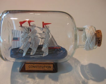
Ship in a Bottle- The USS CONSTITUTION Excellent with Turk's Head Macrame Detail
$16.95
-

Vintage Mayflower Glass Ship in Bottle Santa Maria Hand Blown Glass Sculpture Nautical Decanter Sailor Maritime Office Decor Encyclopaedia
$24.87
-

Hand Blown Glass Ship in a Bottle on Base with SANTA MARIA 1492 Label by Mayflower
$27.00
-
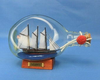
Schooner Ship in a Bottle-- Three Master ATLANTIC 7" long w/Brass Plaque
$28.95
-
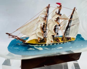
Three Mast Ship in Bottle Nautical Sailing Vessel on Wood Base
$29.99
-

Original Handmade Miniature Sailing Ship, Resin Ocean Diorama, Nautical Desk Decor, Unique Ocean Gift.
Sale Price $30.80
Original Price $38.50
-

Sailing Boat in Bottle Decorative Nautical Home Sailboat Decor
Sale Price $24.00
Original Price $32.00
-

4-1/2" Sailing Ship Print in Embossed Brass Frame- Antique Vintage Style
$28.75


