


Low in stock, only 2 left
Price:$40.00+
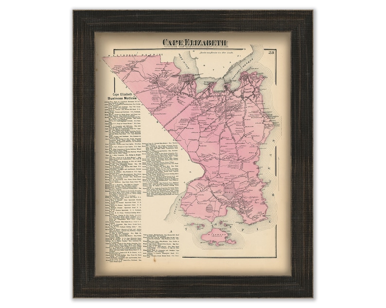
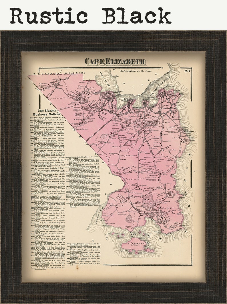
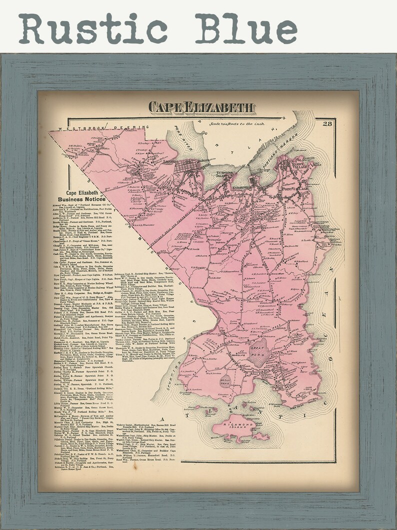
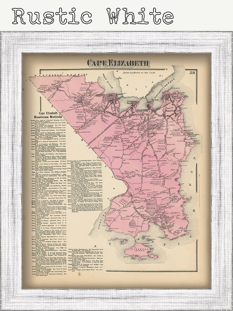
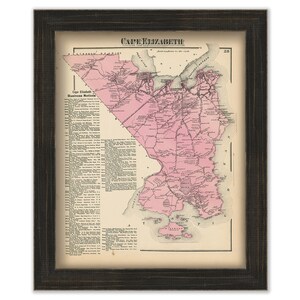
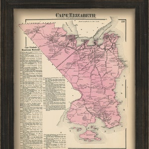
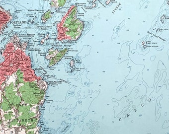
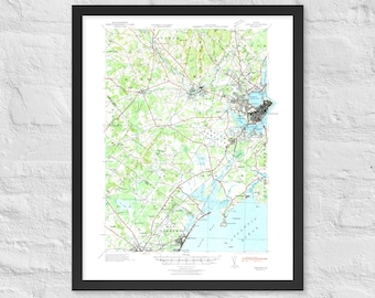
CAPE ELIZABETH, South Portland, Maine 1871 Map, Replica or Genuine ORIGINAL
Star Seller
Star Sellers have an outstanding track record for providing a great customer experience—they consistently earned 5-star reviews, shipped orders on time, and replied quickly to any messages they received.
Your order should arrive by this date if you buy today. To calculate an estimated delivery date you can count on, we look at things like the carrier's latest transit times, the seller's processing time and shipping history, and where the order is shipping to and from.
You can only make an offer when buying a single item
Star Seller. This seller consistently earned 5-star reviews, shipped on time, and replied quickly to any messages they received.
Highlights
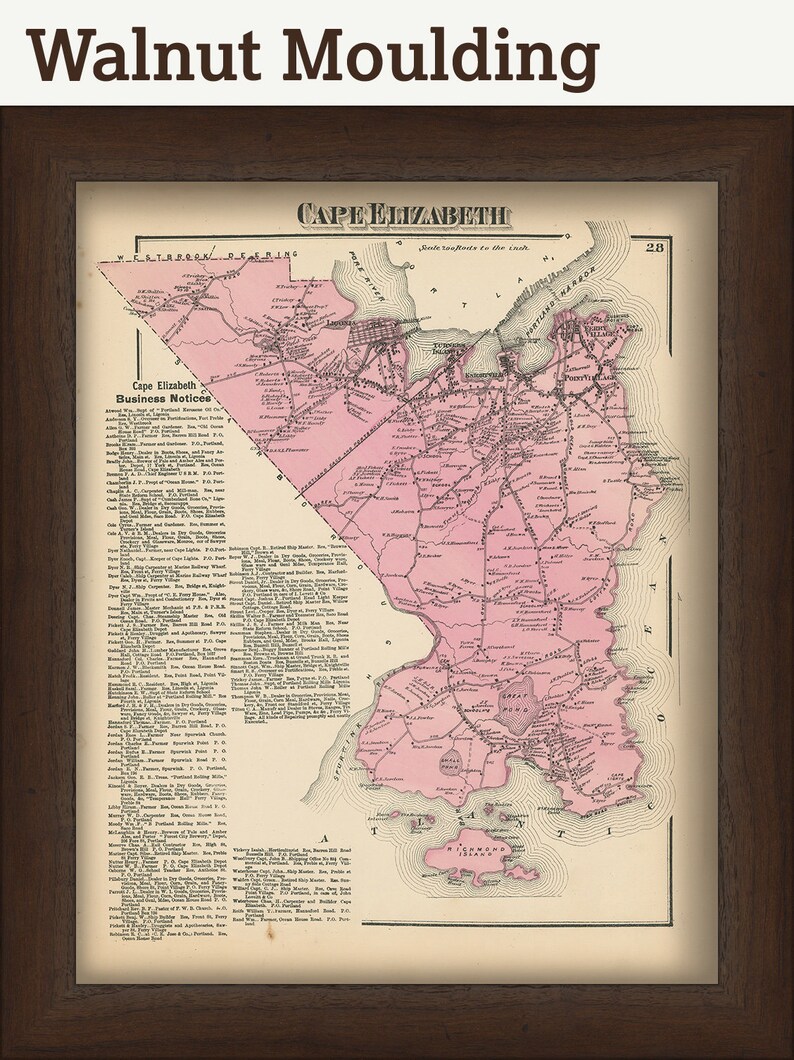
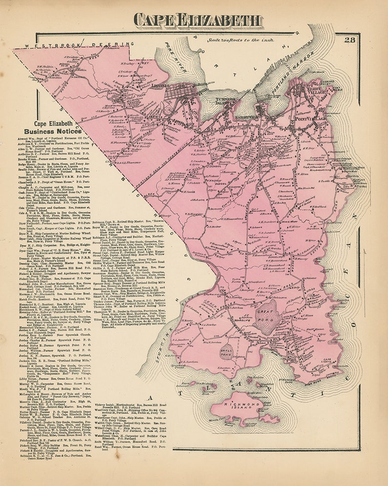
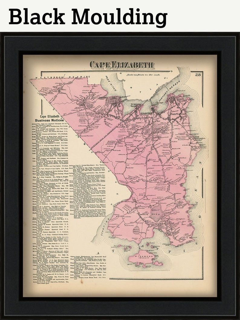
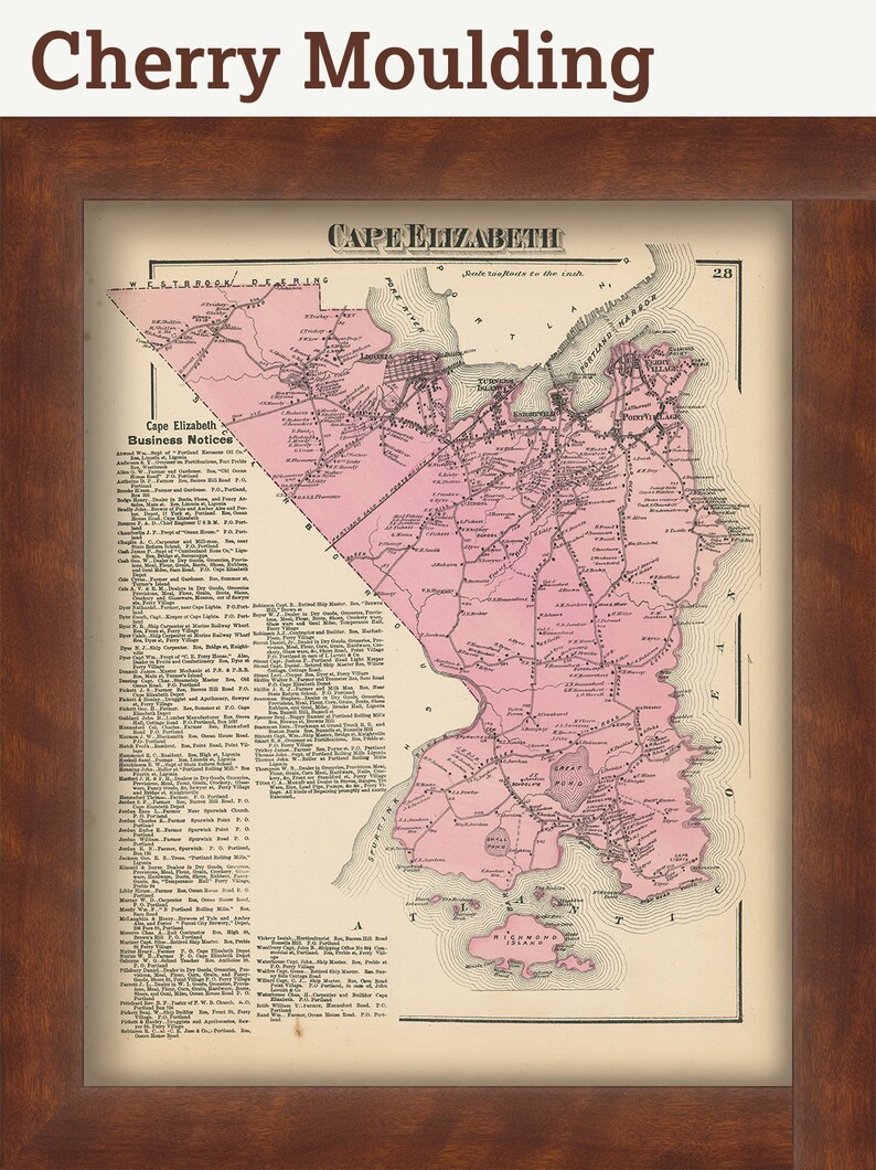
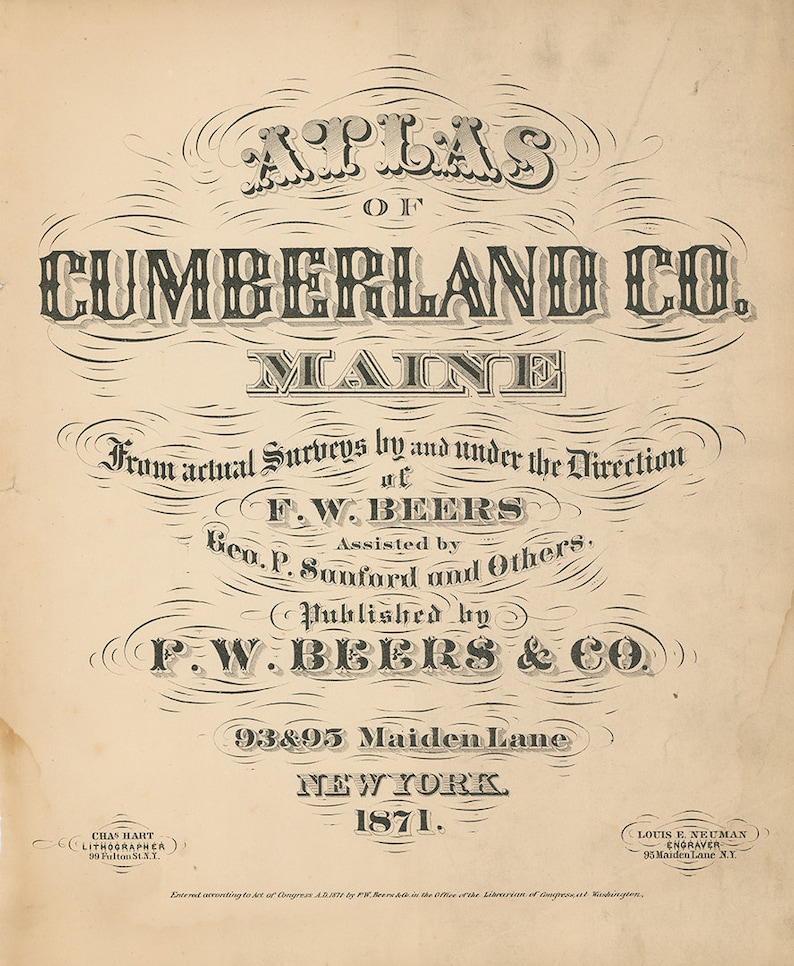
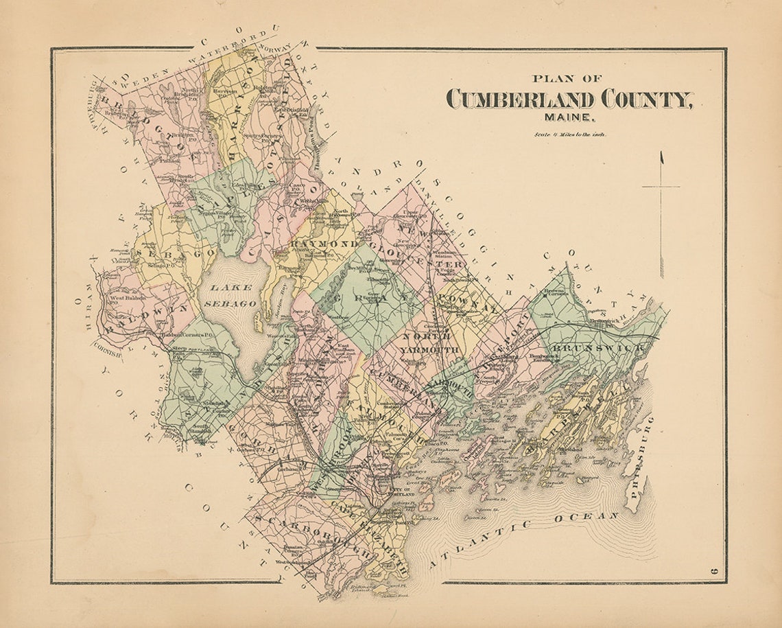
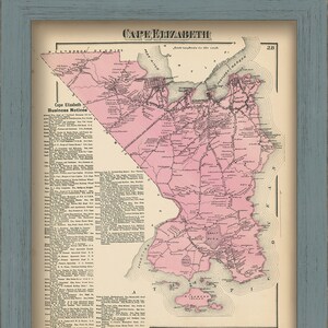
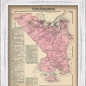
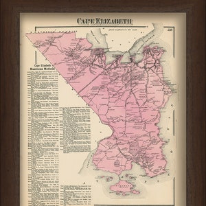
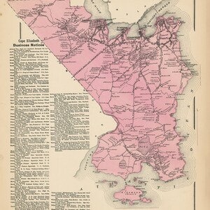
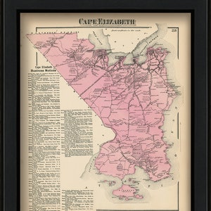
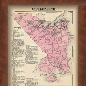
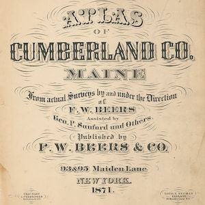
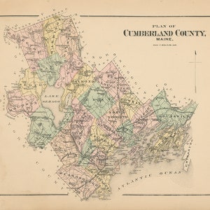
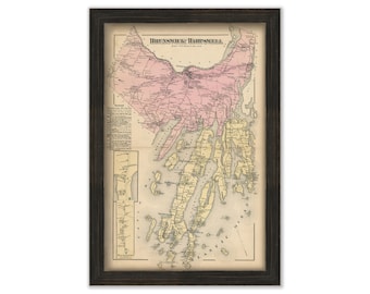
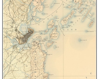
A Map of the Town of CAPE ELIZABETH and SOUTH PORTLAND, Maine, from a Atlas of Cumberland County, Maine, published in 1871 by F. W. Beers and Company.
GENUINE ORIGINAL Dimensions of the Map are: 12.75" by 15.5".
The GENUINE ORIGINAL version of this map is sold.
Some of the Original maps have staining, please check the high resolution version before purchasing.
Please feel free to use our high resolution version of this map for your research or just to inspect it, If you are interested in purchasing the original map, the unedited scan of the map can be viewed here: please copy and paste this url into a new tab in your browser:
https://rmicusec.sirv.com/etsy/Cumberland_County_Maine_1871/CCME1871_pl028.jpg
FRAMED ORIGINAL maps include: museum quality backing board, UV filtering glass, and your choice of mouldings, wired and ready to hang upon delivery.
The Replica Map is printed on heavy matte fine art paper with archival inks.
FRAMED Replica maps include drymounting, UV filtering glass, and your choice of six mouldings, wired and ready to hang upon delivery. All mouldings are approximately 1.5" wide. Please factor in an additional 3" to the listed size for framed items.
This map has been scanned From The ORIGINAL at 600 dpi using state of the art equipment {a Contex Large Format Scanner}. The replica map is printed on heavy matte fine art paper using archival pigment inks. This is one of over 5000 Original maps, charts and posters in our collection.
Many reproduction maps that are available on Etsy are taken directly from public domain sources {NY Public Library, Library of Congress, etc}. Although great for research purposes, these image files frequently suffer from poor color accuracy, lens blur and distortion. The maps in our collection have been scanned from the ORIGINAL, flat, at high resolution and with precisely calibrated color. This allows us to prints replicas that are virtually indistinguishable from the original maps.
Custom sizes are available. If you are interested in a custom size, please let us know through the "ask a question" button in this listing.
Retailers who would like to carry our Maps, please contact us through the "ask a question" button in this listing, for information and discounts.
028-CCME71
-
Order today to get by Jun 25-30
Your order should arrive by this date if you buy today. To calculate an estimated delivery date you can count on, we look at things like the carrier's latest transit times, the seller's processing time and shipping history, and where the order is shipping to and from.
-
Returns & exchanges not accepted
But please contact me if you have problems with your order
-
Free shipping
-
Ships from: Hanover, MA
There was a problem calculating your shipping. Please try again.
Etsy Purchase Protection
Shop confidently on Etsy knowing if something goes wrong with an order, we've got your back for all eligible purchases —
see program terms

Reviews for this item
arrived quickly in great condition


Smooth shipping Has a history of shipping on time with tracking.
Speedy replies Has a history of replying to messages quickly.
Rave reviews Average review rating is 4.8 or higher.
-
Vintage Portland Maine 1957 Survey Map | Casco Bay, South Portland, Portland Harbor, Cape Elizabeth, Falmouth, Cumberland | Unique Wall Art
$65.00
-

Cape Elizabeth Maine Map Print, Cape Elizabeth Poster, Maine Poster, Maine Map Print, Cumberland County, Maine Gift, Gift, Coastal Wall Art
$35.00
-
Cape Elizabeth, Maine. Framed Cut Paper City Map Artwork
$65.00
-
Cape Elizabeth Map | Wood and Epoxy
$199.00
-
Vintage 1894 Cumberland County Maine Map Print | Portland Wall Art
$22.00
-

Cape Elizabeth Light Art Print 8" x 8" Wall Poster By Alan Claude - Maine
$22.00
-

Portland Head Light Art, Portland Head Light Print, Portland Watercolor, Portland Maine Gift, Travel Poster, Portland Head Light art
$12.99
-

Portland Head Light Print - Maine Lighthouse - Cape Elizabeth - Maine Coast - Landscape
$32.00
-
1941 Greater Portland Maine Map | Vintage Topographical Wall Art
$27.00
-

Portland, Cumberland County, Maine ME 1876 (Reproduction Vintage Bird's-eye-view Map) Available in different size.
Sale Price $5.02
Original Price $6.27
-
Portland 1891 Old Topographic Map USGS - Custom Composite Reprint Maine
$40.00
-

Portland Head Light Lighthouse Poster - Cape Elizabeth, Maine - Sizes 8x10, 11x17, 12x18, 16x20, 18x24, 20x30, 24x36
$21.11


Top wedding searches to shop
 Bridesmaid gifts
 Groomsmen gifts
 Wedding gifts
 Engagement gifts

Looking for more? Find it on Etsy