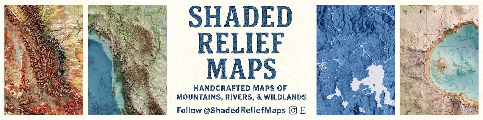
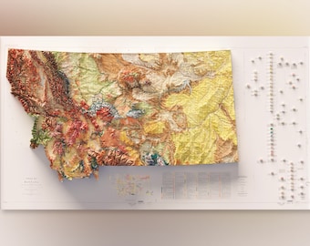

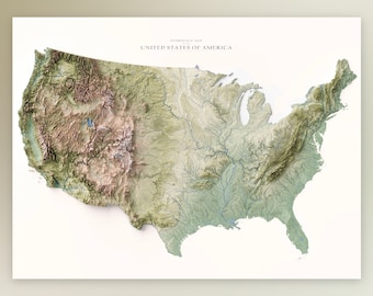
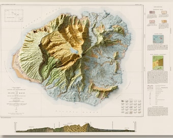
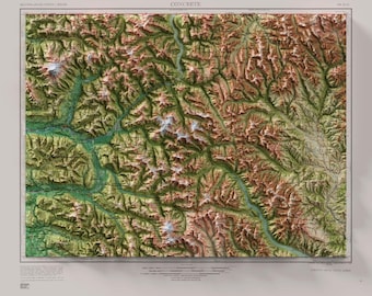
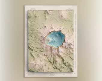
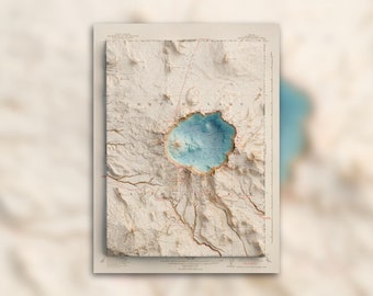
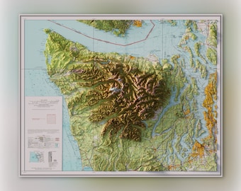
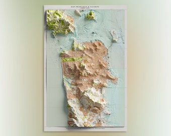
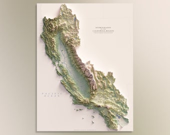
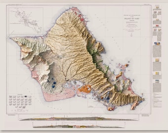
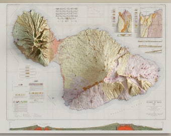
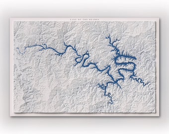
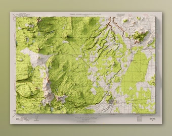
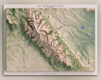
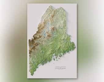
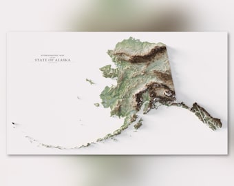
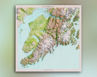

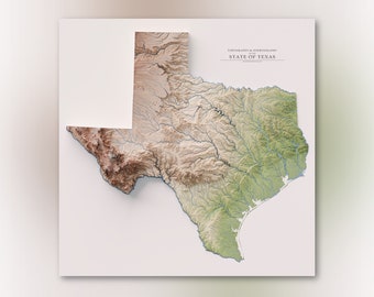
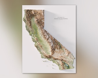
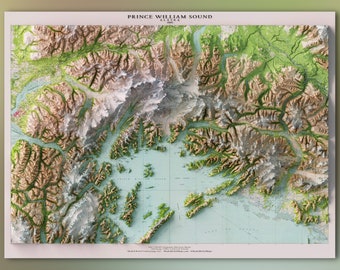
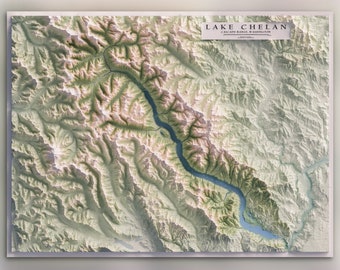
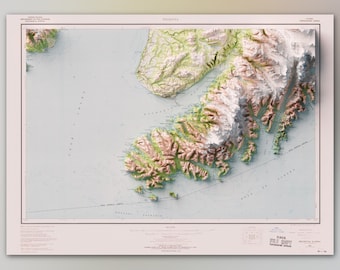
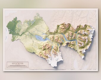
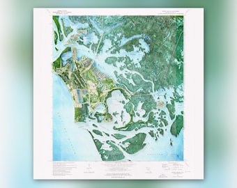
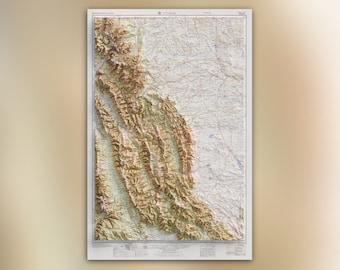
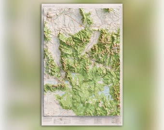
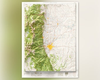
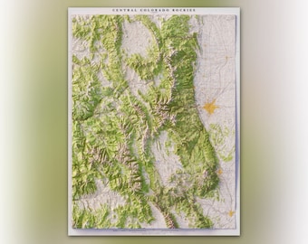
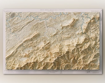
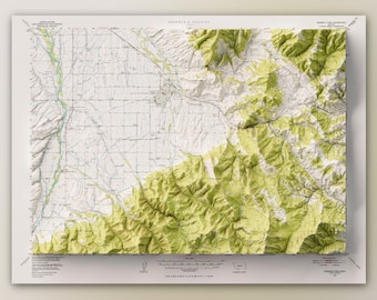
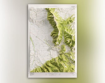
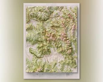
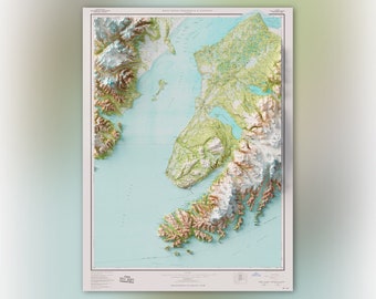
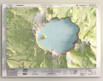
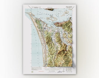

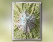
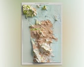
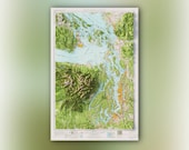
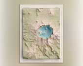
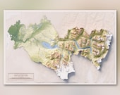
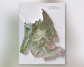

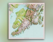

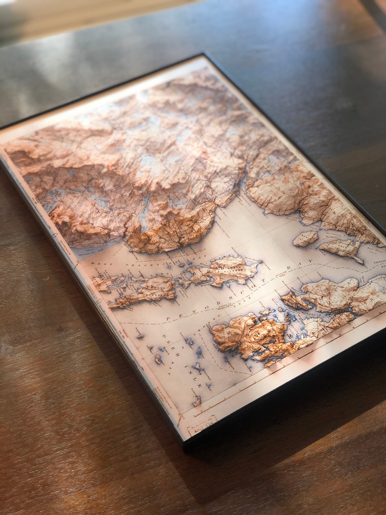
Cartographic Realism - Ray-traced hillshade
---Our Style---
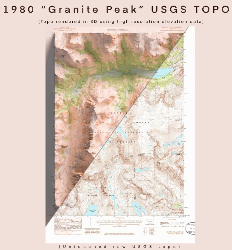
3D modeling meets cartography - We implement accurate, hyper-realistic digital hill shading that makes our maps stand out in the world of cartography. Our technique allows us to make 2D prints that appear 3D thanks to high resolution lighting simulations and elevation data.
NOTE: All our maps are 2D prints. Although appearing 3D they should not be confused with raised relief maps.
Thanks to advancements in 3D modeling technology we can achieve a level of detail not previously possible in map making. Using 3D modeling software intended for CGI we take modern elevation data and drape imagery over these digital models to create ray-traced lighting simulations. The end result are maps that preserve old details and character - re imagined and enhanced with subtle shadows and highlights that enables terrain to be understood intuitively.
-High Quality Prints-
Our posters are printed on professional-quality, silver-halide archival paper and feature a lustre finish (non-glossy), known for excellent print quality and color accuracy. Silver Halide is a 100 year old dark room technology using light-sensitive paper and silver based chemistry, a process which has been constantly refined over time. Silver Halide photographic prints are one of the most archival forms of printing photos and preserving memories. Not only does Fuji Silver Halide paper stand the test of time, it also produces rich tones ideal for cartographic prints. This process offers bold rich blacks, clean whites and an increased color gamut for stronger, brighter, more vibrant colors.
Our canvas prints use museum-quality, poly-cotton blended canvas is tightly wrapped over 100% renewable, knot-free wood. Canvas features a protective gloss finish and perfectly folded corners.
---Shipping---
Poster Prints - You can expect our poster prints to ship in a week after placing your order.
Canvas Wrapped Prints - you can expect larger format prints to ship in 2-3 weeks after placing your order.